DATHFK (Direction And True Heading For Kraken) uses two GPS receivers to determine the direction the vehicle is heading, and its location.
There seems to be a “disconnect” in the communication between the Kraken web interface and the Kraken app, causing the heading and location data not to feed into the app and update the position on the map properly. This has been going on since I first started using it, but I’ve not been able to clearly describe the issues until recently.
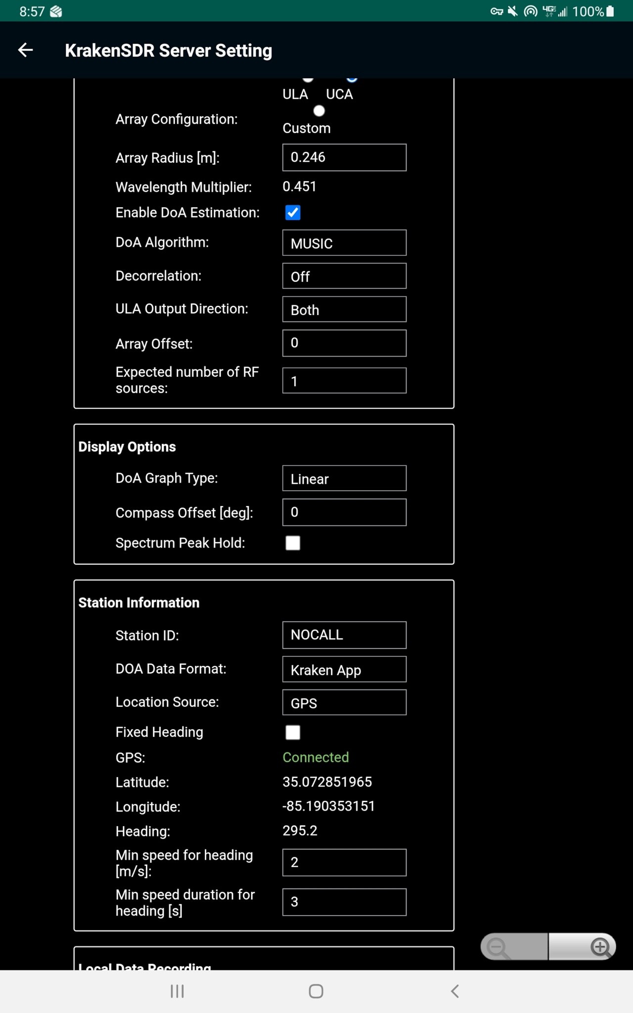
The Kraken app is set to Heading Sensor: Kraken.
The web interface is set to DOA Format: Kraken App, Location Source: GPS
The correct location and heading are ALWAYS displayed here. Always, 100% of the time.
The correct location and heading are ALWAYS displayed here. Always.
However, this data is not getting updated in the Kraken map on any predictable schedule. If I key my HT, it may update immediately, and it may not update even after 5+ keyups.
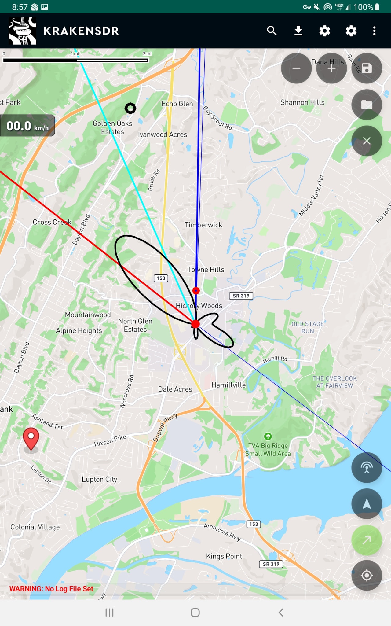
In the above screenshot, the displayed location is where I was at 10am on Thursday. I drove around Thursday and Friday with the Kraken on and updating to different locations, but when I turned it on Monday morning, it showed this location, even though I was 5 miles away. (I had actually driven from home, 5 miles to the NE, and took this screenshot when I arrived at work, 3 miles to the SE.) I keyed up my HT, and it populated the bearing lines, but not the location. I then went to the web app screen, to check that the GPS location and heading were correct, (they were), went back to the app & map, and after keying up a second time, it updated to the correct location.
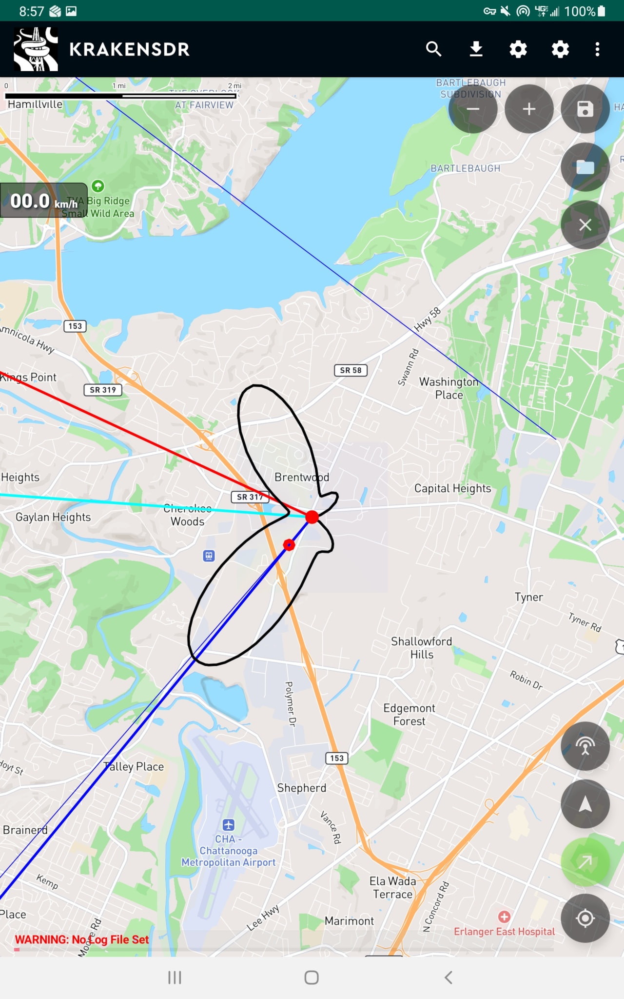
The location and heading shown in the web interface settings is what is shown above, but the screen shots are posted in the order they were taken–web app, old location, new location.-
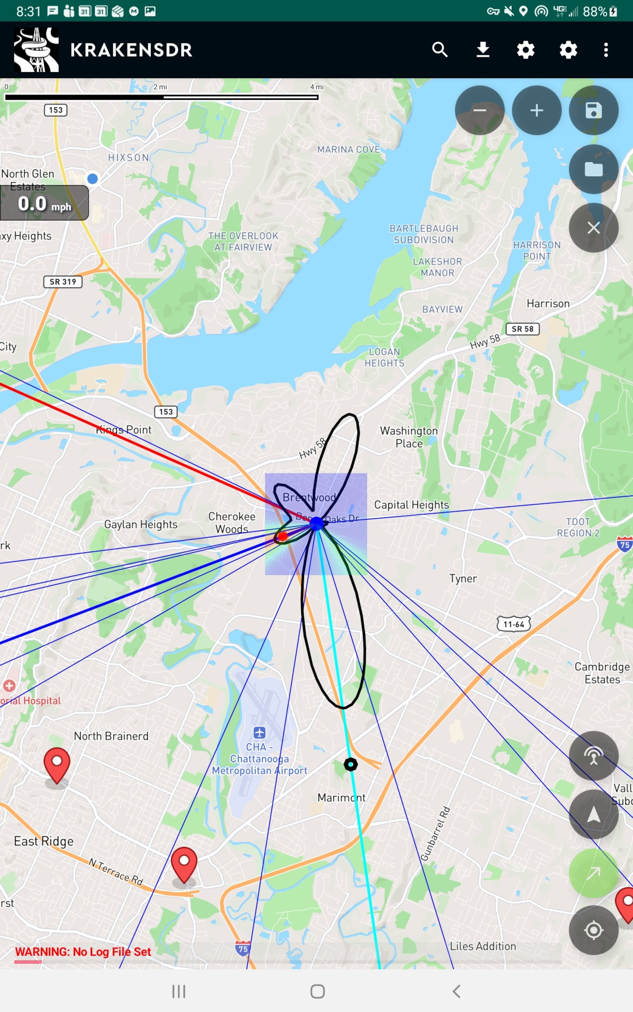
Finally, even using the above settings, if GPS/Location is turned on on my Android tablet, the Kraken app will display that location on the map–see the blue dot by the right corner of the MPH box. With GPS on, the app tracks the location provided by the tablet correctly, but as I drive down the road, it will show one location with the bearing lines and DOA information, and another location of the tablet GPS–it can can accept location data from two different GPS inputs at the same time.
Summary: I need the map to update with the location and heading info provided by the external GPS units, at least every 5-15 seconds (The GPS module updates multiple times a second, but it’s not necessary to update the map that quickly. We’re not doing real-time control of a moving machine here.)